PicoCTF results and writeups
Well PicoCTF ended yesterday and I finished 630th out 12576. Not bad for my second ctf (and by myself at that!). As you can see in my last post, PicoCTF involved many types of problems and programming challenges. I'm gonna use this post to document my writeups (probably will create a GitHub project as well). So lets get on with it!
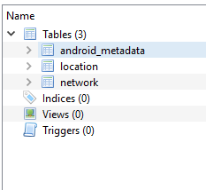
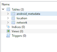 Looking at the data for wigle it was easy to see this was a SQL file. Opening it up with DB Browser listed some interesting data, particularly some longitude and latitude coordinates.


Connect the Wiggle (Forensics)
Task: Identify the data contained within wigle and determine how to visualize it.

My first thought was to look at one of these locations and see where it was. Google maps led my too... the middle of an ocean. Not helpful. I decided I should map all the points since the task said I needed to "visualize" it. Sticking the data into a spreadsheet and uploading it to mapsdata.co.uk allowed me to see all the points at once. Playing with the visualization settings I eventually got this image:
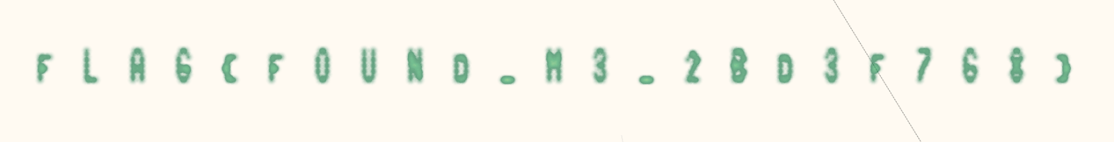
I put this into the site but got an error. It took a while but I figured out that its F0UND with a zero rather than an 'O'.
Flag: FLAG{F0UND_M3_2BD3F7G8}


Comments
Post a Comment